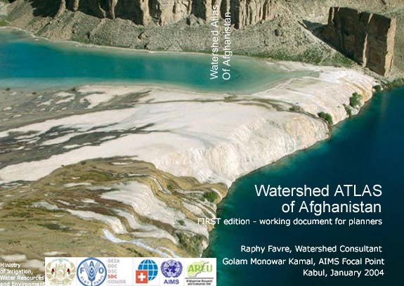
Watershed
Atlas of Afghanistan

This vital publication is a major resource
for development agencies requiring hydrological information
on Afghanistan. The Watershed Atlas has the objective of supporting
natural resource management in Afghanistan with a planning
tool in the form of geo-referenced watershed maps. The watershed
maps have been prepared using Arc-View software and are fully
compatible for area-based statistical analysis. They can be
overlaid with any other geo-referenced maps on Afghanistan.
The Atlas provides two levels of catchment classification:
River Basins; Five River Basins have been defined in Afghanistan
and Watersheds; 41 Watersheds, which includes five non-drainage
areas, have been defined in Afghanistan. The immediate applications
include hydrology, climatology and agriculture production
analysis and monitoring. The Watershed Atlas of Afghanistan
also provides information on watershed development initiatives,
natural resources, climate, agriculture and a set of statistical
data presented by watershed and river basins. The Atlas also
offers 142 geo-referenced pictures and panoramic views in
all regions of Afghanistan which illustrate features of river
basins, watersheds and natural resources and constitute a
visual database for natural resources monitoring. Furthermore,
the hydrology database of Afghanistan, pictures and river
basin/watershed vectors are available on this website.
One of the Atlas key premises is that improving
water use efficiency is essential to achieving smooth and
sustainable development of both Afghanistan and neighboring
countries. In the Afghan context the authors have underlined
the strategic importance of a more detailed classification
for community watershed management work. Preliminary work
on defining social groups indicates that their numbers may
be somewhere between 3000 and 4000. The research concludes
that identifying, mapping the territory and working closely
with these social groups are essential to successful watershed
and natural resources management.
The Watershed Atlas is divided in
five parts:
Part I: Overview of the climatic, water and
natural resources context of Afghanistan. Several maps are
presented on climate, mountain ranges and tectonics, snow
cover satellite imageries, locations of climatic and hydrological
stations and existing and proposed dams. Also, tables on planned
hydropower sector dam projects, sources of irrigation and
formal irrigation schemes are presented. Finally, a brief
discussion on watershed management in Afghanistan is made
with a number of pictures illustrating major issues on watershed
and natural resources management.
Part II: Discussion on methodology for the
classification and delineation of river basin and watershed
boundaries. This section proposes a terminology for four levels
of water catchments areas for Afghanistan.
Part III: Description of the 5 river basins
of Afghanistan. Includes discussions on the trans-boundaries
riparian situation, hydrological infrastructures, environment
and natural resources issues, agriculture patterns and main
historical developments along water sources.
Part IV: Description of the 41 watersheds
of Afghanistan. Includes discussions on watershed features,
sources of rivers and tributaries, land cover and the importance
of agriculture land and graphs on water flow discharge based
on the yearly Hydrological Book data compiled by the Ministry
of Irrigation.
Part V: Conclusion and recommendations, acknowledgments
and bibliography.
The Atlas has been produced by the Ministry
of Irrigation, the Food and Agriculture Organization (FAO),
Afghanistan Information Management Service (AIMS), the Afghan
Research and Evaluation Unit (AREU) and the Swiss Development
and Cooperation (SDC). The Atlas benefited from one year of
informal and voluntary collaborative field and mapping work
undertaken by the authors in 2003.
Watershed Atlas
of Afghanistan
-Volume
I and II
Watershed Atlas of Afghanistan Hydrology
Database
-Databas
Volume I
-Databas
Volume II
|

